
Snow across much of the Carolinas here in the last couple of days. Corey Davis, Assistant State Climatologist for North Carolina, did this storm perform as you thought it was going to going into it?
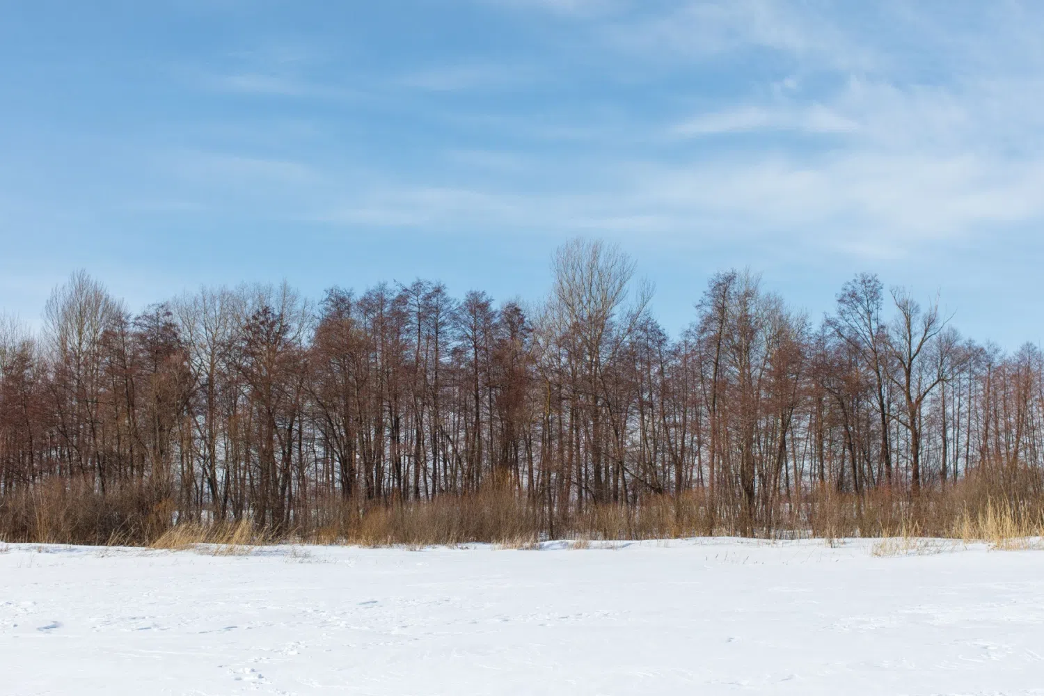
“Mike, especially in parts of the northeastern Piedmont of North Carolina and the northern coastal plain. Think this storm might have over performed. Some of the expectations, some of the forecast I saw leading in, were showing up to about six inches in that part of the state. But looking at the totals that have come in, over the last couple days, we’ve seen eight, nine inches. In some spots, I’ve seen up to 11 inches of snow reported from this event. So a lot of moisture right along the coast there, and we saw it snow fall as all snow in some of those areas, which is unusual. These are parts of the state that only average maybe half an inch to an inch of snow per year. And this is now the second good accumulating snow they’ve seen this winter. They had one in late January that brought a good four or five inches. Now they’ve had this event. So there are parts of Northeastern North Carolina that are going to finish this winter with more than a foot of snow in total. Just amazing for that part of the state where they’re not used to seeing those types, types of amounts.”
No, we really aren’t. And and that’s a part of the state, as we have talked about on several occasions, that is often drier than than other parts of North Carolina, so really unusual for this, when you add on top of it that it’s frozen precipitation.”
“Yeah, you know, that’s a part of the state where they don’t have very deep aquifers or groundwater reserves. It does not take much for that region to slip into drought conditions. But with what we’ve seen over the past month to snow events and just what we’ve seen over the past week with a couple pretty good soaking rain events, they are in really good shape now. And looking further down the coastline, places like Wilmington and Charleston, South Carolina, they haven’t seen quite as much rain recently, and they didn’t see any snow from this event, but at least some of the moisture that they have gotten from some of these recent events. Recent events that will definitely help their drought situation as well. For one, we can see a nice positive improvement on some of the stream flow and deeper soil moisture levels. Obviously, for farmers, that’s for soil moisture is a concern going into the spring planting season, but even with that half an inch to an inch of liquid precept from this event that will go a long way in making sure those fields are in good shape by the time we head into the spring.”
So with the with the rains that we had last week, you know, by the time when we were talking then we knew that we were going to see some more improvement on the Drought Monitor. Are there any areas of the Carolinas still left in any sort of drought?
“We’re really looking at the eastern part of North Carolina and the northeastern corner of South Carolina, where we’ve still got some drought on the map. And again, these are areas that have just consistently missed out week after week. They’ve only been seeing about half an inch of rain per week this time of the year. They average more like an inch per week, so they’ve just been falling that much more into the hole every week that goes by. We actually had some expansion of severe drought on the map this week right along the southern and central coastline in North Carolina, places like Jacksonville, Morehead City. One report that we’ve heard this week is especially from the forestry folks. This is the time of year where they like to get out and do prescribed burning when they can. It helps head off that potential for a bad spring fire season, but with things being as dry as they’ve been recently, they haven’t been able to get that burning done. So that’s one area if they don’t see some more rain going into the springtime, we’ll definitely keep our eyes on because it looks like they are the driest part of the state at the moment.”
Obviously an inch of snow does not equal an inch of rain. Is there a formula that you can use to sort of translate one into the other?
“The rule of thumb is usually a 10 to one ratio, so one inch of liquid would equal 10 inches of snow. But in practice, that’s not always how it works, especially here in North Carolina, where we’re always right on the edge of freezing when we’re getting those very wet snowflakes falling, sometimes we can have as low as an eight to one ratio. But the big exception to that was last month, especially that snow event that we had right along the coastline. It was so cold leading into that event, and while the snow was falling in that event, that we had upwards of a 20 to one liquid to snow ratio. So there were places in parts of eastern North Carolina that only saw a 10th of an inch of liquid falling, and they still got a couple inches of snow out of it. So when you do get that cold air mass in place that can really help to bump up those overall snow totals.”
Let’s take a look at things moving forward. It looks like we’re firmly in the grip of winter at the moment. But how long is that going to last now? Or was Punxsutawney Phil Right? Or is there some hope that spring will come earlier than expected?
“Well, at least for these last couple weeks here in February, he’s been spot on. It has been colder, especially this week, and that is pretty rare here in the Carolinas, in recent years, we have been overwhelmingly warm in the month of February. Just for some perspective about this latest wintry event, over the past decade, we had only had three other statewide snow events during the month of February, and two of those happened back to back at the end of February 2015, so we just haven’t seen these types of wintry patterns come together that often this late in the season. So again, that’s another thing. Along with those high totals in the northeast, it makes this event even more impressive. But looking at the forecast, we do have a slow warm up. At first, we’ll be in the upper 30s to low 40s this afternoon, the mid 40s by tomorrow, finally, by later in the weekend and early next week, we will start a pretty solid, steady warm up into the 50s and then into the 60s. Some areas by the middle of next week, on Tuesday or Wednesday, could see upper 60s for highs. So that will definitely break us out of this colder pattern. Also just looking at the precipitation forecast over the next week, really no significant rain or any other types of precipitation I expected, we will be under the influence of high pressure parked right over our region. That’ll make sure any of those weather systems are steered away from us so it’s looking sunny and then slowly warming up over the next seven days.”